
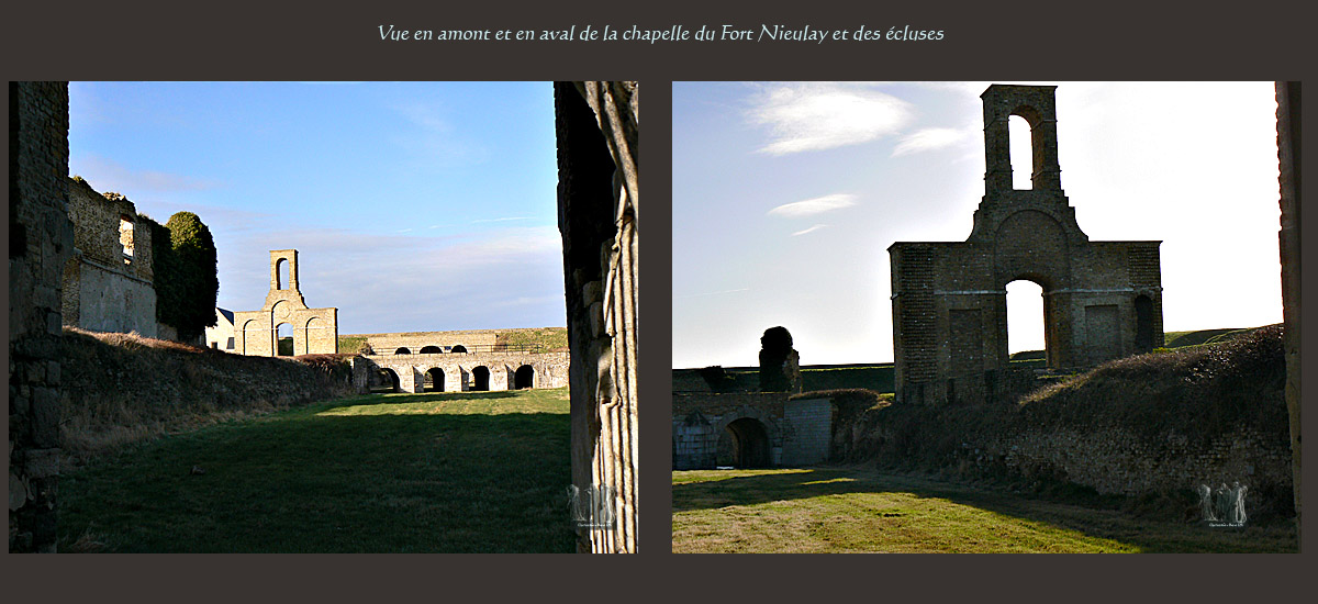
The Nieulay Fort
Summary
A fortress at the entrance to the city
Former access to Calais: The bench Pierrettes
The birth of a true "lock Fort"
A fortress at the entrance to the city
Fort Nieulay is the first monument that appears to the visitor approaching from Calais Boulogne sur Mer. It impresses with its mass accentuated by wide grassy spaces around the space where it is possible to walk.
Located west of the city, it was once a major military defensive elements of Calais.
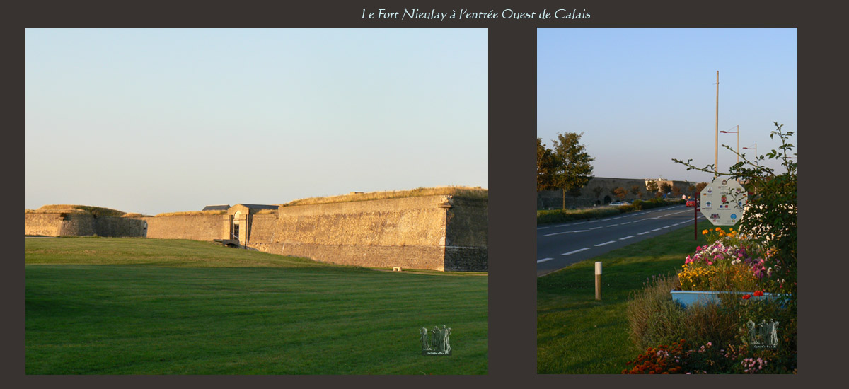
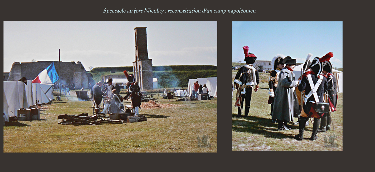
Place to walk and various celebrations (fireworks, guided tours, animations by costumed troops ...), it is also an important historical testimony to the art of fortification since it would be the last fort - locks of France. The destiny of this fort is directly linked to its exceptional location ...
Former access to Calais: The bench Pierrettes
In ancient times, a vast gulf occupied the Calais; it stretched from Cap Blanc Nez in Oudenbourg Belgium. The tides, the gulf is loaded gradually giving way to wetlands crossings here and there streams.
These rivers flowed the river Hames from Guines, who was also called the New River or Pierrettes channel. This river pierced a dunes and shingle: The bench Pierrettes at the cove called Neuna (current site of the fort).
On the edges of what remained of the Gulf, east of Pierrettes bench, settled fishermen who formed the hamlets of Calais and Pétresse (who later became Saint Pierre). Surrounded by marshes, Calais was therefore accessible by the carriageway provided on this bench that allowed to cross the cove of first Neuna ford and later by a bridge.
What is the etymology of the word "Nieulay"?
The name comes from the Flemish "nieuwlet", which means "new channel" or "new stream".
This bridge was an obvious strategic interest since it was the gateway to Calais. It created a market-tolls (or toll) that travelers and merchants had to pay to cross it. And it was under the British occupation, we decided for the first time to strengthen control of the bridge ...
The birth of a true "lock Fort"
The appearance of the first lock and the first fort in the English occupation
In 1346, the British built, to control the entrance to the town, most likely composed initially of embankments and fences.
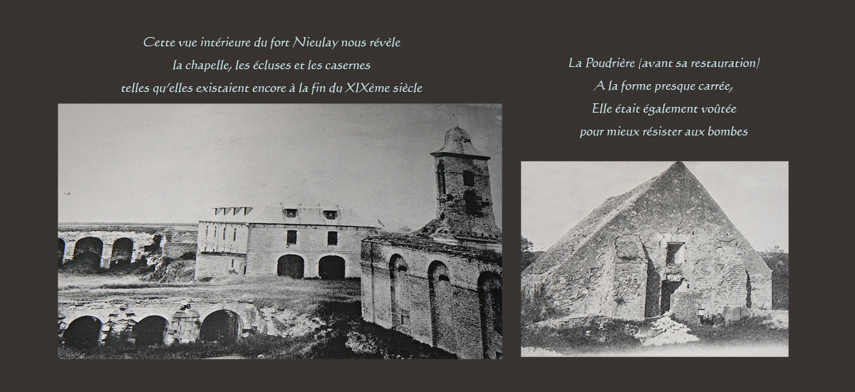
Subsequently, they raised the bridge is a true square watchtower provided at each corner of a tower. A plan from 1545 attests. This fort stood under fire from his guns locks constructed to contain the water. In case of enemy invasion, it was possible to destroy the locks and cause flooding across the low Calais.
Note: in spite of these, the troops of the Duc de Guise reached after a cannonade of two hours traveling mistresses fort without locks were destroyed ...
The bastion fortifications
→ The fort under Spanish occupation
The Spanish occupation began in 1596, when the first bastions appear (see also section on the Citadel). To better withstand the new weapons, the Spaniards reduce the height of the towers to give less control to the artillery. They reinforce the fort by building large masonry parapets and bastions.
→ The fort under Louis XIII and Cardinal Richelieu
Cardinal Richelieu decided to build all the fortifications of the region. In 1627 he built upstream of the river a hornwork to defend more effectively locks. Downstream, the fort was enlarged and covers an area of 260 x 60 m. Ditches to a depth of 7 to 8 meters around the fort.
80 people can fit inside the fort, which, if attacked, can accommodate reinforcements from the nearby Citadel. From 1655 these two forts were also directly connected to each other by a dam which was itself defended by a redoubt called "the fort to the crabs." The latter disappeared around 1870.
→ The fort since Louis XIV…
Following the visits of King Louis XIV and the Marquis de Vauban, it was decided to rebuild the fort further west, to encompass the locks. These were in fact considered essential for the defense of Calais since offered an ultimate means of defense against the attacker by flooding the land: they had to be impregnable "as strong Nieulay remain" (Vauban). Three locks were built inside the fort and thus allow the flow of water in the country and the introduction of seawater.
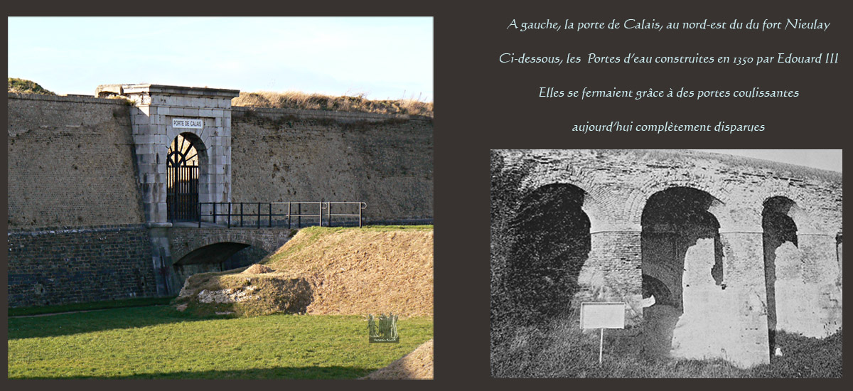
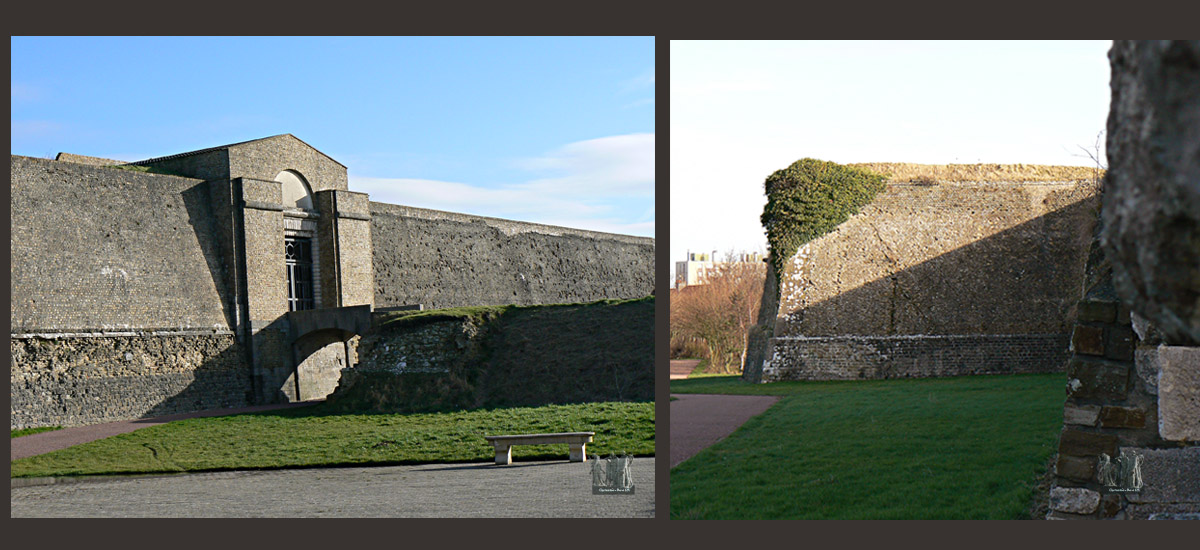
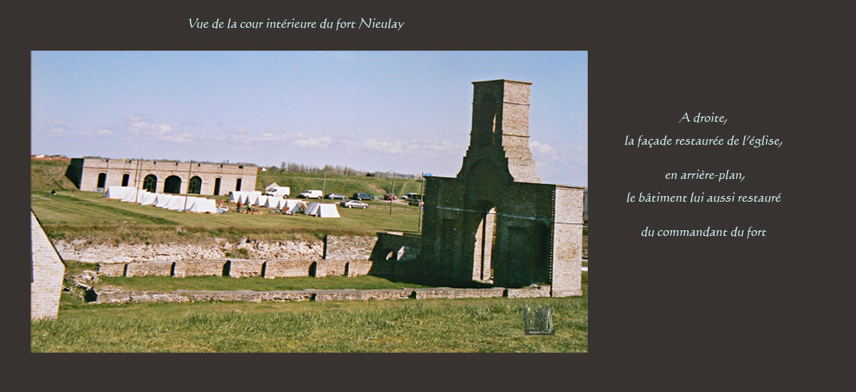
The fort is thus again enlarged to finally extend over an area of 340 x 176 m. It comes with two doors to the east gate of Calais or royal gate, and west, the door to door or Boulogne Dauphine. Each of these doors is defended by a half-moon. The paths described baffles, one entered in through the side of the halfpipe.
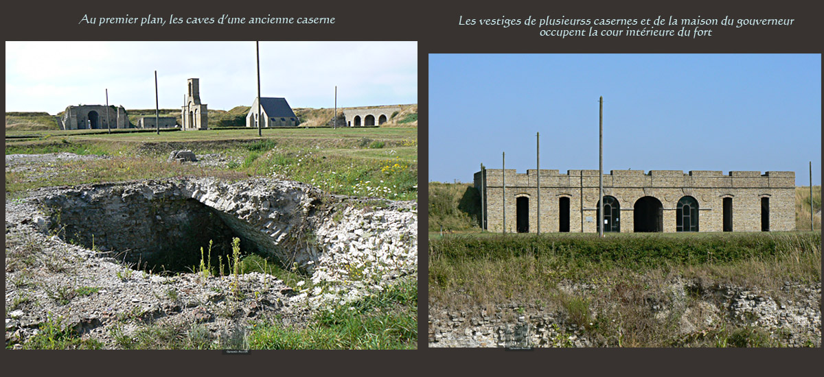
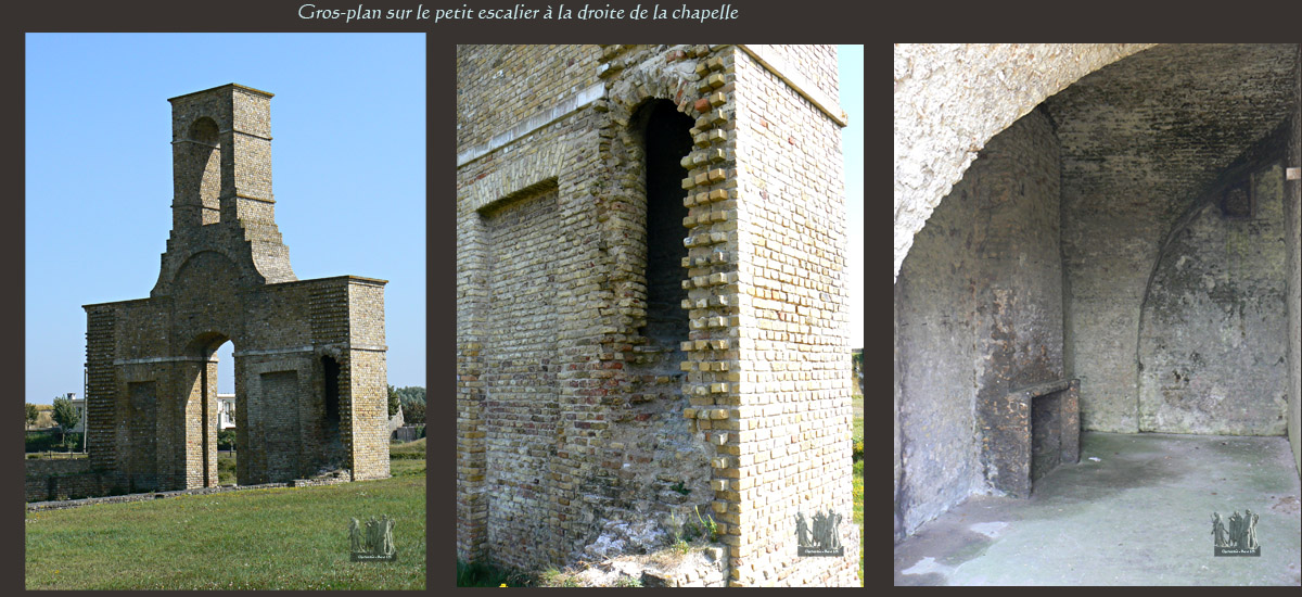
The fortress included housing for the principal officers in the east, two-storey barracks in the north, an arsenal, shops, a cistern behind the barracks could hold 1,900 hectoliters of water ...
A difficult conversion
An abandoned fort
Towards the end of the 18th century, the fort begins to lose its strategic importance. Meanwhile, rivers diverted to lock Asfeld make unnecessary locks due to the drying of the soil. Nothing is done to remove sand channel and maintain the equipment. The north face of the fort, still covered by the sea in Vauban, being without a natural defense. Abandoned and open to all comers until 1870, the fort was severely degraded. In 1870 he finally again occupied by a garrison of Engineering, but briefly: in 1903, it is permanently decommissioned and sold.
In search of a new conversion
→A place of pasture and shooting ranges…
Decommissioned in 1903, the fort was sold and then leased to farmers who settled on its glaze their cattle. In the 1920s, shooting companies settled stalls in the old fortress ... The years passed and the abandonment of the strong state deepened.
→At the forefront of heavy fighting…
Despite its decay, the fortress was still the place of fighting during the Second World War in May 1940, fifty-resistant tried to delay the German advance ... in vain. The Germans then occupied the fort, there built a blockhouse, anti-aircraft batteries .... In September 1944, Canadian troops dislodged the German soldiers flamethrower and liberated the entire city.
→Mining its basements…
After the war, the owners of the fort exploited the bench stones and huge cavities were dug which water filled. These excavations provoked the collapse of the nose of the southeast bastion. The operation stopped.
→Inadequate rehabilitation…
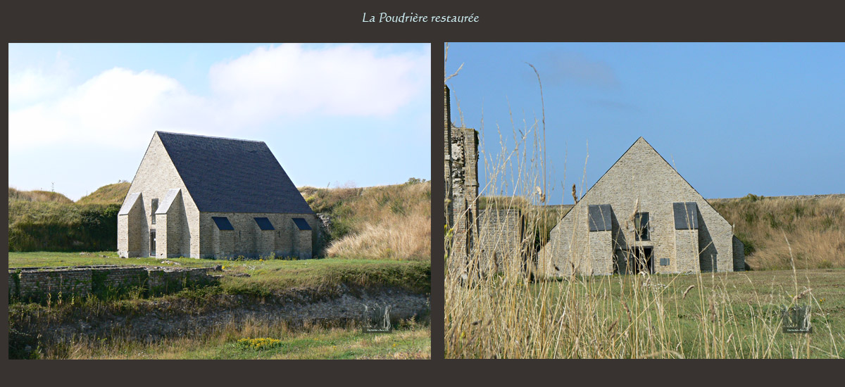
In 1975, the City of Calais purchased the fort and decided to restore it. Significant work was undertaken in the 1980s for its restoration. Today, one can freely wander at the foot of the ramparts. In July and August, it is possible to access the interior of the fort. Off season, however, it is best to check the schedules and opening dates: 03 21 46 66 41. Guided tours are possible…
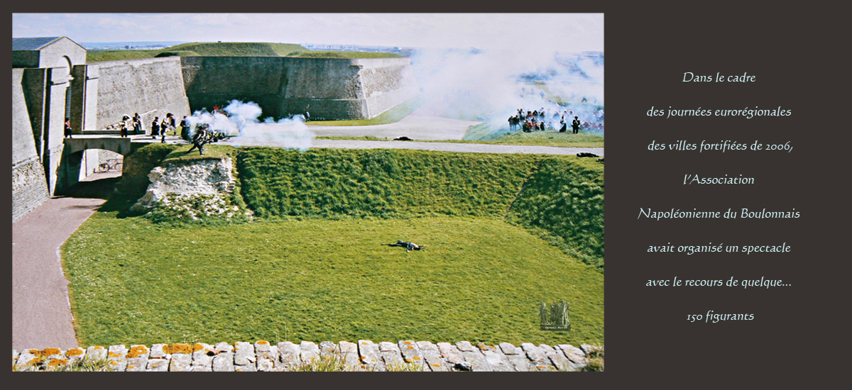
Punctually, cultural events are organized inside the box (theater, fireworks, entertainment ...). In addition, each year on the occasion of the Euro-regional days, which generally take place in late April, guided tours are free, as well as exhibitions…
Overall, however, we must recognize that this wonderful heritage Meurice in Calais is underutilized. Worse still very exposed to the wind and, as we have seen, long abused by men, it deteriorates again very disturbing way. Cracks appear, and it is hoped that the restoration work will soon be undertaken if we want to enjoy much longer this unique hard-locks France.
Small coastal lexicon
BENCH :
Large piles of sand and mud, or more solid materials, forming a more or less horizontal layer.
A BIEF:
Space between the two locks of a canal.
A CANAL :
natural or artificial way for the flow of water on earth.
CORD OF DUNES:
natural sand barrier that forms between the beach and inland. Formed with the winds and currents, it isolates and protects the soil from invasion from the sea.
A DIKE :
Lifting earth or masonry to hold the water.
A LOCK:
hydraulic structure consisting essentially of doors equipped with valves, designed to regulate a stream retaining or releasing water as needed. It makes the navigable rivers, allowing the passage of vessels of a reach to another.
A GULF:
Part of sea enters the land, and the opening towards the sea is usually very wide.